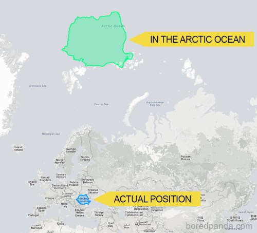
 The reason why certain countries looks bigger or smaller than others is because of something called the Mercator Projection. Putting a 3D planet on a two-dimensional map was something of a challenge for early cartographers and so a Flemish geographer and cartographer named Gerardus Mercator came up with a solution.
Source: After Seeing These 30 Maps You’ll Never Look At The World The Same | Bored Panda
Categories: Articole de interes general

Leave a comment